
New Study: Remotely sensed water budgets for energy-limited Midwest Ag
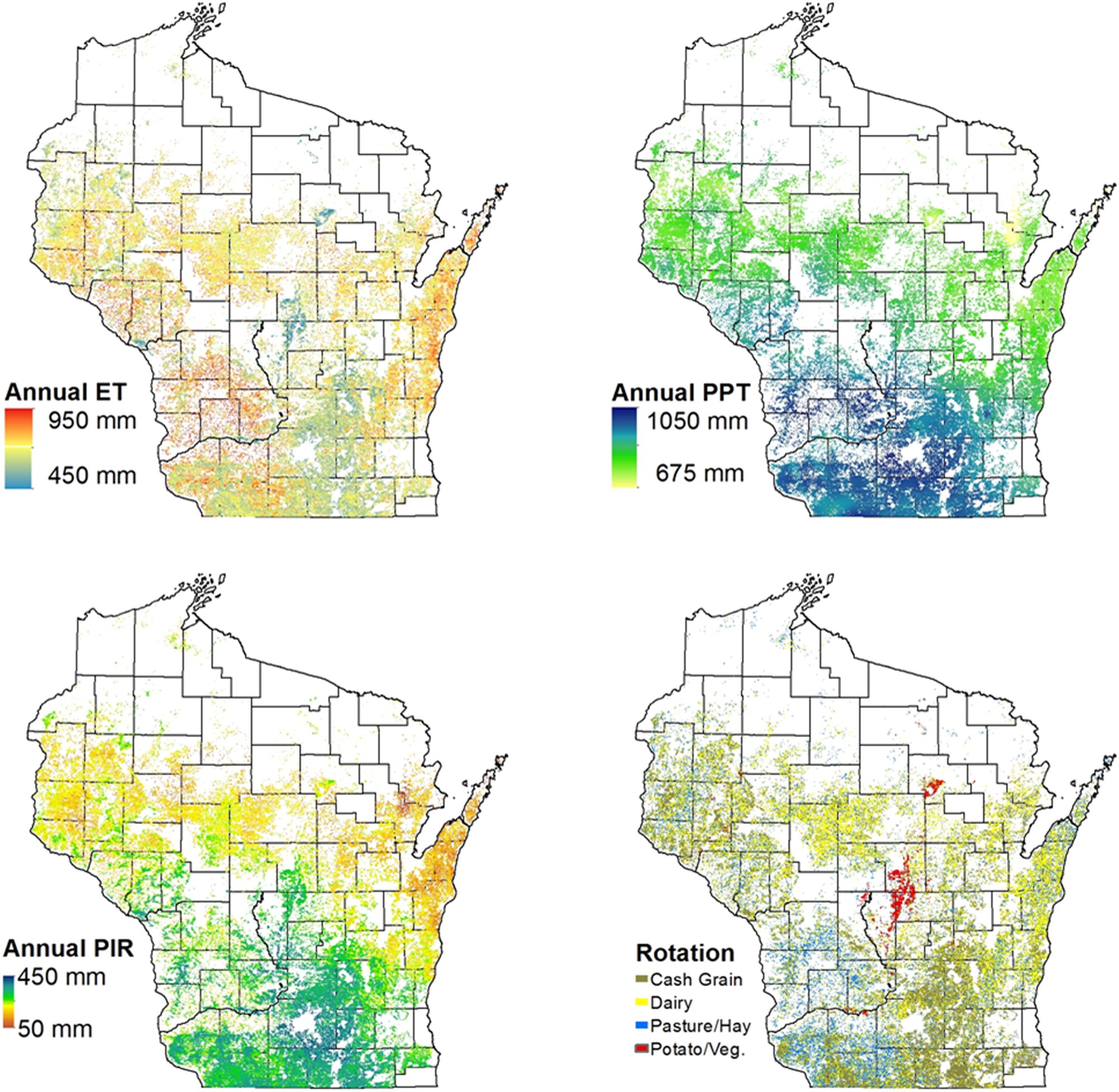
Annual evapotranspiration, precipitation (PPT), potential infiltration and runoff (PIR), and crop rotations in Wisconsin, USA
We validated existing remote sensing ET packages to estimate water budgets across Wisconsin Agricultural Lands
Process-based hydrological models using remote sensing datasets can often be the best tools for water management and policy. However, it can be labor, time, and resource intensive for regional and state water organizations to deploy these models quickly when there is a management need. To meet this need, Dr. Mallika Nocco collaborated on a team of scientists led by longtime friend and collaborator Dr. Bob Smail (Wisconsin Department of Natural Resources) to use gridded ET datasets and develop water budgets for WI agricultural lands. Unlike California, ET from Wisconsin agricultural lands was most often energy-limited as opposed to water-limited. This means that they were limited in ET values by the evaporative demand of the environment. Surprisingly, we found that there were no significant differences in ET between irrigated and rainfed agriculture—perhaps because of differences in crop timing, rotation, and soils as well as the mentioned energy limitation. As you may expect, perennial crops had the lowest infiltration/runoff (combined estimate in this study) compared to annual cropping systems.